Saturday, June 29, 2013

Wildfire Smoke Health Advisory for portions of south-central and southwest Colorado

*** You are subscribed to Winterairquality.denvermetro as mcnamaratr@co.laplata.co.us. If you wish to unsubscribe, or modify your preferences please visit http://mailman.listserve.com/listmanager/options/winterairquality.denvermetro/mcnamaratr%40co.laplata.co.us or to learn more about our list visit http://mailman.listserve.com/listmanager/listinfo/winterairquality.denvermetro ***

-------- Original Message --------
Subject: [Winterairquality.denvermetro] Wildfire Smoke Health Advisory for portions of south-central and southwest Colorado
From: winterairquality.denvermetro@listserve.com
To: Thomas McNamara <Thomas.McNamara@co.laplata.co.us>
CC:


Inline image 1

Wildfire Smoke Health Advisory

Issued for portions of south-central and southwest Colorado

Issued by Colorado Department of Public Health and Environment

Issued at 9:00 AM Saturday, June 29, 2013

Affected Area Portions of south-central and southwest Colorado, including the San Juan, Piedra and upper Rio Grande River Valleys and sections of the Rio Grande and San Juan National Forests. Cities impacted include, but are not limited to Pagosa Springs, Piedra, Arboles, Spar City, Creede, South Fork, Lake City, Silverton, South Fork, Del Norte, Durango, Cortez, Telluride, and Montrose.

Advisory in Effect: 9:00 AM Saturday, June 29, 2013 to 9:00 AM Sunday, June 30, 2013

Public Health RecommendationsIf smoke is thick or becomes thick in your neighborhood you may want to remain indoors. This is especially true for those with heart disease, respiratory illnesses, the very young, and the elderly. Fine particulates may reach the Unhealthy category where smoke is heavy. Consider limiting outdoor activity when moderate to heavy smoke is present. People with heart or lung disease, older adults, and children should avoid prolonged or heavy exertion; everyone else should reduce prolonged or heavy exertion. Consider relocating temporarily if smoke is present indoors and is making you ill. IF VISIBILITY IS LESS THAN 5 MILES IN SMOKE IN YOUR NEIGHBORHOOD, SMOKE HAS REACHED LEVELS THAT ARE UNHEALTHY. 

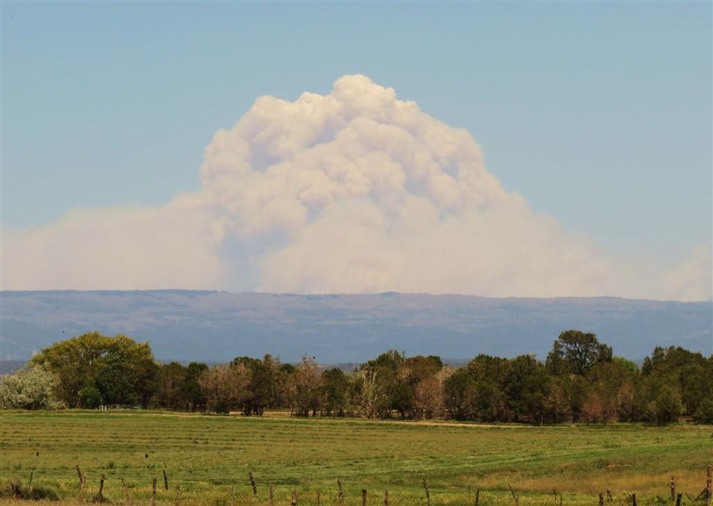
Outlook:  Light winds under the high pressure system over the Great Basin will keep smoke from wildfires in Colorado and New Mexico over much of south-central and southwestern Colorado.  Afternoon and evening showers and thunderstorms will cause some areas to mix the smoke out and cause other areas to have increased smoke impacts today.  The largest smoke impacts will be in areas where the smoke pools overnight and in the early to mid morning.  In some valleys where the pooling occurs  like the Rio Grande River Valley west of Del Norte Variable the smoke may not mix out until showers and thunderstorms move across in the afternoon.  Cities potentially impacted include, but are not limited to Pagosa Springs, Piedra, Arboles, Spar City, Creede, South Fork, Lake City, Silverton, South Fork, Del Norte, Durango, Cortez, Telluride, and Montrose.

For the latest Smoke Outlook, visit:

http://www.colorado.gov/airquality/addendum.aspx#smoke

For more information about smoke and your health, visit:

http://www.colorado.gov/airquality/wildfire.aspx

For the latest Colorado statewide air quality conditions, forecasts, and advisories, visit:
http://www.colorado.gov/airquality/colorado_summary.aspx

Social Media:

http://www.facebook.com/cdphe.apcd
http://twitter.com/#!/cdpheapcd

Friday, June 28, 2013

SMOKE RETURNS TONIGHT FROM WEST FORK AND NM FIRES

> WWUS85 KGJT 282248
> SPSGJT
>
> SPECIAL WEATHER STATEMENT
> NATIONAL WEATHER SERVICE GRAND JUNCTION CO
> 448 PM MDT FRI JUN 28 2013
>
> COZ006-011-014-017>023-UTZ022-027>029-291300-
> GRAND VALLEY-CENTRAL GUNNISON AND UNCOMPAHGRE RIVER BASIN-
> UPPER GUNNISON RIVER VALLEY-UNCOMPAHGRE PLATEAU AND DALLAS DIVIDE-
> NORTHWEST SAN JUAN MOUNTAINS-SOUTHWEST SAN JUAN MOUNTAINS-
> PARADOX VALLEY/LOWER DOLORES RIVER-
> FOUR CORNERS/UPPER DOLORES RIVER-ANIMAS RIVER BASIN-
> SAN JUAN RIVER BASIN-SOUTHEAST UTAH-ARCHES/GRAND FLAT-
> LA SAL AND ABAJO MOUNTAINS-CANYONLANDS/NATURAL BRIDGES-
> INCLUDING THE CITIES OF...GRAND JUNCTION...FRUITA...PALISADE...
> CEDAREDGE...DELTA...HOTCHKISS...MONTROSE...GUNNISON...CIMARRON...
> RIDGWAY...GLADE PARK...OURAY...TELLURIDE...LAKE CITY...
> SILVERTON...RICO...HESPERUS...GATEWAY...NUCLA...CORTEZ...
> DOVE CREEK...MANCOS...DURANGO...BAYFIELD...IGNACIO...
> PAGOSA SPRINGS AND VICINITY...BLANDING...BLUFF...MEXICAN HAT...
> MOAB...CASTLE VALLEY...THOMPSON SPRINGS...MONTICELLO AND VICINITY
> 448 PM MDT FRI JUN 28 2013
>
> ..SMOKE FROM WILD FIRES HAVE REDUCED VISIBILITIES...
>
> WILD FIRES IN COLORADO AND NEW MEXICO HAVE CONTRIBUTED TO
> WIDESPREAD SMOKE AND HAZE ACROSS SOUTHEAST UTAH AND SOUTHWEST
> COLORADO. IN SOME INSTANCES THE SMOKE AND HAZE HAS SIGNIFICANTLY
> REDUCED VISIBILITIES TO LESS THAN 3 MILES. THE CITY OF BLUFF
> OBSERVED VISIBILITIES TO LESS THAN 1 MILE EARLY THIS MORNING.
>
> SMOKE IS LIKELY TO CONCENTRATE IN THE LOWER VALLEYS ONCE AGAIN
> LATE TONIGHT AND SATURDAY MORNING. LOCALLY POOR VISIBILITIES OF
> LESS THAN 3 MILES...IN SOME INSTANCES LESS THAN 1 MILE...WILL
> OCCUR. THE VALLEYS OF EXTREME SOUTHEAST UTAH AND EXTREME
> SOUTHWEST COLORADO...INCLUDING THE TOWNS OF PAGOSA SPRINGS...
> DURANGO...CORTEZ...AND BLUFF MAY HAVE CONSIDERABLE SMOKE AND HAZE
> ONCE AGAIN. HAZY CONDITIONS MAY EXTEND FARTHER NORTH AND AFFECT
> MOAB AND THE GRAND VALLEY.
>
> PEOPLE WITH RESPIRATORY PROBLEMS OR OTHER HEALTH CONCERNS SHOULD
> STAY INSIDE AS MUCH AS POSSIBLE. REFRAIN FROM EXERCISING OUTDOORS
> OR ANY OTHER RECREATION ACTIVITIES.
>
> $$
>
>
>
>
>
> www.weather.gov/

RED FLAG WARNING issued for #LaPlataCo Friday Hot and Dry with Dry Lightning and gusty erratic outflow winds

WWUS85 KGJT 281031
RFWGJT

URGENT - FIRE WEATHER MESSAGE
NATIONAL WEATHER SERVICE GRAND JUNCTION CO
431 AM MDT FRI JUN 28 2013

..RED FLAG WARNING IN EFFECT FROM 1 PM TO 9 PM MDT FRIDAY OVER THE SAN JUAN MOUNTAINS AND UTAH PORTIONS OF THE TAVAPUTS PLATEAU FOR DRY THUNDERSTORMS AND GUSTY OUTFLOW WINDS...

.THUNDERSTORMS WITH NARROW RAIN SHAFTS WILL INCREASE THIS AFTERNOON WITH A RISING THREAT OF DRY LIGHTNING...ACCOMPANIED BY GUSTY OUTFLOW WINDS.

COZ207-291-UTZ483-484-487-282245-
/O.CON.KGJT.FW.W.0026.130628T1900Z-130629T0300Z/
DURANGO FORECAST AREA-NORTHERN SAN JUAN FORECAST AREA- SOUTHERN ASHLEY NATIONAL FOREST-TAVAPUTS PLATEAU-BOOK CLIFFS-
431 AM MDT FRI JUN 28 2013

..RED FLAG WARNING REMAINS IN EFFECT FROM 1 PM THIS AFTERNOON TO
9 PM MDT THIS EVENING FOR DRY THUNDERSTORMS AND GUSTY OUTFLOW WINDS FOR FIRE WEATHER ZONES 207...291...483...484 AND 487...

* AFFECTED AREA...
IN COLORADO...
FIRE WEATHER ZONE 207 DURANGO FORECAST AREA AND
FIRE WEATHER ZONE 291 NORTHERN SAN JUAN FORECAST AREA.
IN UTAH...
FIRE WEATHER ZONE 483 SOUTHERN ASHLEY NATIONAL FOREST...
FIRE WEATHER ZONE 484 TAVAPUTS PLATEAU AND
FIRE WEATHER ZONE 487 BOOK CLIFFS.

* THUNDERSTORMS...THE THREAT OF THUNDERSTORMS WILL LITTLE
RAINFALL IS ON THE INCREASE. THE BEST CHANCE FOR DRY LIGHTNING
WILL BE FROM MID AFTERNOON THROUGH EARLY EVENING.

* OUTFLOW WINDS...GUSTY WINDS WILL BE ERRATIC AND PEAK GUSTS OF
50 MPH MAY OCCUR.

* IMPACTS...CRITICAL DRY THUNDERSTORM THREAT EXIST WITH
LIGHTNING OCCURRING OUTSIDE OF NARROW RAIN SHAFTS. COMBINED
WITH DRY FUELS...THE THREAT OF DRY LIGHTNING IS ENHANCED.

PRECAUTIONARY/PREPAREDNESS ACTIONS...

A RED FLAG WARNING MEANS THAT CRITICAL FIRE WEATHER CONDITIONS ARE EITHER OCCURRING NOW...OR WILL SHORTLY. A COMBINATION OF STRONG WINDS...LOW RELATIVE HUMIDITY...AND WARM TEMPERATURES CAN CONTRIBUTE TO EXTREME FIRE BEHAVIOR.

PLEASE ADVISE THE APPROPRIATE OFFICIALS AND AFFECTED FIELD PERSONNEL OF THIS RED FLAG WARNING.

&&

$$

FOR MORE INFORMATION FROM NOAA/NATIONAL WEATHER SERVICE VISIT...
HTTP://WEATHER.GOV/GJT (ALL LOWER CASE)


www.weather.gov/

San Juan Basin Health Department Smoke Safety Information - Health Reminder

Health Reminder


Date: June 21, 2013

Contact: Bari Wagner, San Juan Basin Health

    335-2028; email: bwagner@sjbhd.org


Liane Jollon, Interim Executive Director of the San Juan Basin Health Department, has issued a health reminder on June 20, 2013 due to the smoke from numerous wildfires affecting the air quality in southwest Colorado.


Elderly persons, young children, pregnant women and persons with pre-existing circulatory or respiratory conditions should limit outdoor activity when smoke is visible in the sky.


The following are recommendations from the Colorado Department of Public Health and Environment (CDPHE) on steps to take if wildfire smoke is affecting your health:

  • If you smell smoke and/or are beginning to experience symptoms, consider temporarily locating to another area as long as it is safe for you to do so.
  • Seek out locations where air is filtered. For example, heading to the local mall, movie theater or recreation center can provide some temporary relief. Local health officials often can help locate places with better air quality during extended smoke episodes.
  • Close windows and doors and stay indoors. However, do not close up your home tightly if it makes it dangerously warm inside.
  • Only if they are filtered, run the air conditioning, the fan feature on your home heating system (with the heat turned off) or your evaporative cooler. Keep the outdoor air intake closed and be sure the filter is clean. Filtered air typically has less smoke than the air outdoors. Running these appliances if they are not filtered can make indoor smoke worse.
  • If you have any HEPA room air filtration units, use them.
  • In smoky air reduce your physical activity level. Avoid exercise or other strenuous activities in heavy smoke. If smoke is simply unpleasant or mildly irritating, changing the timing of a few activities may be all that is necessary.
  • Give extra attention to the things that help keep a person healthy at any time. Make healthy eating choices, drink plenty of fluid, get ample sleep, and exercise in clean air. To the extent that you can, avoid or mitigate stress by keeping in touch with friends and family, and using other methods of taking a break from worries.
  • Commercially available dust masks may seem like a good idea, but they do virtually nothing to filter out the particles and gasses in smoke.

At Night:

·         At night smoke may move in different directions than smoke does in the day, and can be heavy--especially if the outdoor air is still. It tends to be worse near dawn.

  • Close bedroom windows at night.
  • To prepare for nighttime smoke, consider airing out your home during the early or middle of the afternoon when smoke tends to be more diluted. Use your best judgment. If smoke is thick during the day, follow the tips above.

For more information, see CDPHE’s web page on wildfire smoke:  http://www.colorado.gov/airquality/wildfire.aspx


Thursday, June 27, 2013

US 160 WOLF CREEK PASS UPDATE - US 160 OVER WOLF CREEK PASS REMAINS CLOSED DUE TO FIRE

News From The Colorado Department of Transportation

www.coloradodot.info


Media Contacts:  Nancy Shanks, CDOT Public Relations

(970) 385-1428 office, (970) 749-3579 mobile

Greg Heule, Public Information Officer

Rocky Mtn. Type I Incident Management Team, (719) 569-4149

 
June 27, 2013


US 160 OVER WOLF CREEK PASS REMAINS CLOSED DUE TO FIRE


Multi-agency, multi-jurisdictional team in planning stages for

possible reopen this Saturday


MINERAL/RIO GRAND COUNTIES – Due to forest fires in the area (including the West Fork Fire), US 160 over Wolf Creek Pass (between South Fork on the east side to east of Pagosa Springs on the west side) remains closed.


The road closure began on June 20 at 2:21p.m. The alternate southern route between Alamosa and Pagosa Springs is US 285 from Alamosa to SH 17 (Cumbres/La Manga Pass) to US 84 into Pagosa Springs. The multi-agency/multi-jurisdictional incident command team is working towards a possible opening of the pass on Saturday, June 29.


PLEASE NOTE: this opening is dependent upon three main events:  the local fire evacuation orders must be lifted prior to the highway opening; the comprehensive traffic control plan details need to be finalized (for safe escort of motorists); and the fire behavior must remain moderate. Travelers must check CDOT’s traveler information site at www.cotrip.org before making travel plans.


Information about this fire and other incidents nationwide is available at www.inciweb.org.


#  #  #

Monday, June 24, 2013

Monday #LaPlataCo wildfire update: RED FLAG WARNING in effect, NO wildfire in La Plata County at this time

As of this post, there are no known wildfires in La Plata County. A RED FLAG WARNING has been issued for today from Noon until 9PM (details Below). Our fuels are drying out more and more the longer we go without rain. We have also been hearing of many wells and springs going dry.

The effects of a drought come in many forms. What is most evident is wildfire danger. We have clearly seen the massive smoke columns to our east over the past week and should see them as a wake up call to be proactive. We all have a role in protecting our homes, our families and our community.

The types of large fires we are seeing recently are different than have been seen in a long time. These fires move faster, burn hotter, rage at higher elevations and are more difficult to predict. The latest information from the West Fork Fire Complex is that due to the rugged terrain, fuel type, and the extreme fuel conditions firefighters can not directly fight the fire. Our forests here have little difference to those burning to our east today. Although we don't have the extent of beetle killed forests, there is enough fuel there to create a similar disaster. Even areas of the Missionary Ridge Fire have what were standing dead trees, laying like giant pick-up-sticks throughout hills.

We have been lucky that there have been few lightening strikes in our County this season. We are thankful that most of our community has taken our dry conditions seriously and haven't had a devastating accident. We are proud of our local industry and businesses taking proactive steps to manage their business safely.

Keep it up La Plata County!

What you can do to help you and your home is check out http://www.readycolorado.gov  and http://csfs.colostate.edu/pages/are-you-firewise-program.html to find ways to protect yourself from wildfire. I personally spent all weekend with my family checking our evacuation kit, mowing overgrown grass, trimming trees up from their bases, cleaning gutters of dead leaves and moving wood and other fuels away from our house. If you haven't done these things, now is the time.


URGENT - FIRE WEATHER MESSAGE
NATIONAL WEATHER SERVICE GRAND JUNCTION CO
525 AM MDT MON JUN 24 2013

..A RED FLAG WARNING FOR MOST OF WESTERN COLORADO AND NORTHEAST UTAH FROM NOON UNTIL 9 PM MDT TODAY FOR MUCH OF THE AREA...FOR GUSTY WINDS...LOW HUMIDITY...DRY FUELS...AND HAINES INDEX OF 6...


.GUSTY SOUTHWEST WINDS WILL RETURN THIS AFTERNOON AS ANOTHER DISTURBANCE BRUSHES THE REGION. THE WINDS WILL COMBINE WITH VERY LOW RELATIVE HUMIDITY AND DRY FUELS FOR CRITICAL FIRE WEATHER CONDITIONS.

COZ200>203-207-290>293-UTZ482>484-486-487-242330-
/O.CON.KGJT.FW.W.0025.130624T1800Z-130625T0300Z/
LITTLE SNAKE FORECAST AREA-ROUTT FORECAST AREA- WHITE RIVER FORECAST AREA-GRAND JUNCTION FORECAST AREA- DURANGO FORECAST AREA-PARADOX VALLEY FORECAST AREA- NORTHERN SAN JUAN FORECAST AREA-NORTH FORK FORECAST AREA- GUNNISON BASIN FORECAST AREA-WESTERN UINTA BASIN- SOUTHERN ASHLEY NATIONAL FOREST-TAVAPUTS PLATEAU- EASTERN UINTA BASIN-BOOK CLIFFS-
525 AM MDT MON JUN 24 2013

..RED FLAG WARNING REMAINS IN EFFECT FROM NOON TODAY TO 9 PM MDT THIS EVENING FOR GUSTY WINDS...LOW HUMIDITY...AND DRY FUELS FOR FIRE WEATHER ZONES 200...201...202...203 BELOW 9000 FEET...207 BELOW
9000 FEET...290...291 BELOW 9500 FEET...292...293 BELOW 10500 FEET...
AND ZONES 482...483...484...486 AND 487 ALL BELOW 7000 FEET...

* AFFECTED AREA...

  IN COLORADO...

  FIRE WEATHER ZONE 200 LITTLE SNAKE FORECAST AREA...
  FIRE WEATHER ZONE 201 ROUTT FORECAST AREA...
  FIRE WEATHER ZONE 202 WHITE RIVER FORECAST AREA...
  FIRE WEATHER ZONE 203 BELOW 9000 FEET GRAND JUNCTION FORECAST
       AREA...
  FIRE WEATHER ZONE 207 BELOW 9000 FEET DURANGO FORECAST AREA...
  FIRE WEATHER ZONE 290 PARADOX VALLEY FORECAST AREA...
  FIRE WEATHER ZONE 291 BELOW 9500 FEET NORTHERN SAN JUAN FORECAST
       AREA...
  FIRE WEATHER ZONE 292 NORTH FORK FORECAST AREA...
  FIRE WEATHER ZONE 293 BELOW 10500 FEET GUNNISON BASIN FORECAST
       AREA.

  IN UTAH...

  FIRE WEATHER ZONE 482 BELOW 7000 FEET WESTERN UINTA BASIN...
  FIRE WEATHER ZONE 483 BELOW 7000 FEET SOUTHERN ASHLEY NATIONAL
       FOREST...
  FIRE WEATHER ZONE 484 BELOW 7000 FEET TAVAPUTS PLATEAU...
  FIRE WEATHER ZONE 486 BELOW 7000 FEET EASTERN UINTA BASIN...
  FIRE WEATHER ZONE 487 BELOW 7000 FEET BOOK CLIFFS.

* WINDS...SOUTHWEST 15 TO 25 MPH WITH GUSTS UP TO 35 MPH.

* RELATIVE HUMIDITY...8 TO 13 PERCENT.

* HAINES INDEX...6 HIGH.

* IMPACTS...RAPID FIRE GROWTH ON ANY WILDFIRES OR PRESCRIBED
  BURNS AND AGRICULTURAL BURNS IS PROBABLE. OPEN BURNING IS NOT
  RECOMMENDED.

PRECAUTIONARY/PREPAREDNESS ACTIONS...

A RED FLAG WARNING MEANS THAT CRITICAL FIRE WEATHER CONDITIONS ARE EITHER OCCURRING NOW...OR WILL SHORTLY. A COMBINATION OF STRONG WINDS...LOW RELATIVE HUMIDITY...AND WARM TEMPERATURES CAN CONTRIBUTE TO EXTREME FIRE BEHAVIOR.

PLEASE ADVISE THE APPROPRIATE OFFICIALS AND AFFECTED FIELD PERSONNEL OF THIS RED FLAG WARNING.

&&

$$

FOR MORE INFORMATION FROM NOAA/NATIONAL WEATHER SERVICE VISIT...
HTTP://WEATHER.GOV/GJT (ALL LOWER CASE)

Saturday, June 22, 2013

RED FLAG WARNING IN EFFECT FOR #LAPLATACO THROUGH TONIGHT. WINDS ARE EXPECTED TO PICK UP TODAY


-------- Original Message --------
Subject: DENRFWGJT
From: EWARN- <ldad@noaa.gov>
To:
CC:

WWUS85 KGJT 221140
RFWGJT

URGENT - FIRE WEATHER MESSAGE
NATIONAL WEATHER SERVICE GRAND JUNCTION CO
540 AM MDT SAT JUN 22 2013

..RED FLAG WARNING CONTINUES FOR MOST OF WESTERN COLORADO AND
NORTHEAST UTAH FOR THIS AFTERNOON AND INTO THE EVENING FOR MUCH
OF THE AREA...FOR GUSTY WINDS...LOW HUMIDITY...DRY FUELS... AND
HAINES INDEX OF 6...

.A TIGHT PRESSURE GRADIENT ACROSS EASTERN UTAH AND WESTERN
COLORADO WILL REMAIN IN PLACE THROUGH THIS AFTERNOON AS A WEAK
DISTURBANCE ROTATES AROUND A LOW PRESSURE SYSTEM CENTERED NORTH OF
MONTANA ALONG THE ALBERTA/SASKATCHEWAN BORDER. GUSTY SOUTHWEST
WINDS WILL MIX TO THE SURFACE SATURDAY AFTERNOON AND EARLY EVENING
AND WILL COMBINE WITH VERY LOW RELATIVE HUMIDITY AND DRY FUELS FOR
CRITICAL FIRE WEATHER CONDITIONS.

COZ200-202-203-207-290>293-UTZ486-487-222345-
/O.CON.KGJT.FW.W.0024.130622T1800Z-130623T0300Z/
LITTLE SNAKE FORECAST AREA-WHITE RIVER FORECAST AREA-
GRAND JUNCTION FORECAST AREA-DURANGO FORECAST AREA-
PARADOX VALLEY FORECAST AREA-NORTHERN SAN JUAN FORECAST AREA-
NORTH FORK FORECAST AREA-GUNNISON BASIN FORECAST AREA-
EASTERN UINTA BASIN-BOOK CLIFFS-
540 AM MDT SAT JUN 22 2013

..RED FLAG WARNING REMAINS IN EFFECT FROM NOON TODAY TO 9 PM MDT
THIS EVENING FOR GUSTY WINDS...LOW HUMIDITY...AND DRY FUELS FOR
FIRE WEATHER ZONES 200...202...203 BELOW 9000 FEET...207 BELOW 9000
FEET...290...291...292...293 BELOW 10500 FEET...486 AND 487 BOTH
BELOW 7000 FEET...

* AFFECTED AREA...

  IN COLORADO...

  FIRE WEATHER ZONE 200 LITTLE  SNAKE FORECAST AREA...
  FIRE WEATHER ZONE 202 WHITE RIVER FORECAST AREA...
  FIRE WEATHER ZONE 203 BELOW 9000 FEET GRAND JUNCTION FORECAST
       AREA...
  FIRE WEATHER ZONE 207 BELOW 9000 FEET DURANGO FORECAST AREA...
  FIRE WEATHER ZONE 290 PARADOX VALLEY FORECAST AREA...
  FIRE WEATHER ZONE 291 NORTHERN SAN JUAN FORECAST AREA...
  FIRE WEATHER ZONE 292 NORTH FORK FORECAST AREA...
  FIRE WEATHER ZONE 293 BELOW 10500 FEET GUNNISON BASIN FORECAST
       AREA.

  IN UTAH...

  FIRE WEATHER ZONE 486 BELOW 7000 FEET EASTERN UINTA BASIN AREA...
  FIRE WEATHER ZONE 487 BELOW 7000 FEET BOOK CLIFFS.

* WINDS...WEST 10 TO 20 MPH WITH GUSTS UP TO 30 MPH.

* RELATIVE HUMIDITY...9 TO 14 PERCENT.

* HAINES INDEX...6 HIGH.

* IMPACTS...RAPID FIRE GROWTH ON ANY WILDFIRES OR PRESCRIBED
  BURNS AND AGRICULTURAL BURNS IS POSSIBLE. OPEN BURNING IS NOT
  RECOMMENDED.

PRECAUTIONARY/PREPAREDNESS ACTIONS...

A RED FLAG WARNING MEANS THAT CRITICAL FIRE WEATHER CONDITIONS
ARE EITHER OCCURRING NOW...OR WILL SHORTLY. A COMBINATION OF
STRONG WINDS...LOW RELATIVE HUMIDITY...AND WARM TEMPERATURES CAN
CONTRIBUTE TO EXTREME FIRE BEHAVIOR.

PLEASE ADVISE THE APPROPRIATE OFFICIALS AND AFFECTED FIELD
PERSONNEL OF THIS RED FLAG WARNING.

&&

$$

FOR MORE INFORMATION FROM NOAA/NATIONAL WEATHER SERVICE VISIT...
HTTP://WEATHER.GOV/GJT (ALL LOWER CASE)


www.weather.gov/

Friday, June 21, 2013

RED FLAG WARNING CONTINUES into Saturday for HOT DRY WINDY conditions and VERY dry fuels!

#LaPlataCo is under continuing fire weather warnings.
Remember that there are fire restrictions throughout the region.

WWUS85 KGJT 212110
RFWGJT

URGENT - FIRE WEATHER MESSAGE
NATIONAL WEATHER SERVICE GRAND JUNCTION CO
310 PM MDT FRI JUN 21 2013

..RED FLAG WARNING THROUGH EARLY THIS EVENING...AND AGAIN FOR SATURDAY AFTERNOON AND INTO THE EVENING FOR MUCH OF THE AREA...FOR GUSTY WINDS...LOW HUMIDITY...DRY FUELS...AND HAINES INDEX OF 6...

.A TIGHT PRESSURE GRADIENT ACROSS EASTERN UTAH AND WESTERN COLORADO WILL REMAIN IN PLACE THROUGH SATURDAY AS ENERGY ROTATES AROUND A LOW PRESSURE SYSTEM CENTERED NORTH OF MONTANA ALONG THE ALBERTA/SASKATCHEWAN BORDER. GUSTY SOUTHWEST WINDS WILL MIX TO THE SURFACE DURING THE AFTERNOONS AND EARLY EVENINGS AND WILL COMBINE WITH VERY LOW RELATIVE HUMIDITY AND DRY FUELS FOR CRITICAL FIRE WEATHER CONDITIONS.

COZ200-202-203-207-290>293-UTZ486-487-220915-
/O.NEW.KGJT.FW.W.0024.130622T1800Z-130623T0300Z/
/O.CON.KGJT.FW.W.0023.000000T0000Z-130622T0300Z/
LITTLE SNAKE FORECAST AREA-WHITE RIVER FORECAST AREA- GRAND JUNCTION FORECAST AREA-DURANGO FORECAST AREA- PARADOX VALLEY FORECAST AREA-NORTHERN SAN JUAN FORECAST AREA- NORTH FORK FORECAST AREA-GUNNISON BASIN FORECAST AREA- EASTERN UINTA BASIN-BOOK CLIFFS-

310 PM MDT FRI JUN 21 2013

..RED FLAG WARNING REMAINS IN EFFECT UNTIL 9 PM MDT THIS EVENING FOR GUSTY WINDS...LOW HUMIDITY...AND DRY FUELS FOR COLORADO FIRE WEATHER ZONES 200...202...290...291...292...293 AND ZONES 203 AND
207 BOTH BELOW 9000 FEET...AND UTAH FIRE WEATHER ZONES 486 AND
487 BOTH BELOW 7000 FEET...

..RED FLAG WARNING IN EFFECT FROM NOON TO 9 PM MDT SATURDAY FOR GUSTY WINDS...LOW HUMIDITY...AND DRY FUELS FOR COLORADO FIRE WEATHER ZONES 200...202...290...291...292...293 AND ZONES 203 AND
207 BOTH BELOW 9000 FEET...AND UTAH FIRE WEATHER ZONES 486 AND
487 BOTH BELOW 7000 FEET...

THE NATIONAL WEATHER SERVICE IN GRAND JUNCTION HAS ISSUED A RED FLAG WARNING FOR GUSTY WINDS...LOW HUMIDITY...AND DRY FUELS...
WHICH IS IN EFFECT FROM NOON TO 9 PM MDT SATURDAY.

* AFFECTED AREA...

IN COLORADO...

FIRE WEATHER ZONE 200 LITTLE SNAKE FORECAST AREA...
FIRE WEATHER ZONE 202 WHITE RIVER FORECAST AREA...
FIRE WEATHER ZONE 203 BELOW 9000 FEET GRAND JUNCTION FORECAST
AREA...
FIRE WEATHER ZONE 207 BELOW 9000 FEET DURANGO FORECAST AREA...
FIRE WEATHER ZONE 290 PARADOX VALLEY FORECAST AREA...
FIRE WEATHER ZONE 291 NORTHERN SAN JUAN FORECAST AREA...
FIRE WEATHER ZONE 292 NORTH FORK FORECAST AREA...
FIRE WEATHER ZONE 293 BELOW 10500 FEET GUNNISON BASIN FORECAST
AREA.

IN UTAH...

FIRE WEATHER ZONE 486 EASTERN UINTA BASIN
FIRE WEATHER ZONE 487 BOOK CLIFFS.

* WINDS...SOUTHWEST 10 TO 20 MPH WITH GUSTS UP TO 35 MPH.

* RELATIVE HUMIDITY...6 TO 11 PERCENT.

* HAINES INDEX...6 HIGH.

* IMPACTS...RAPID FIRE GROWTH ON ANY WILDFIRES OR PRESCRIBED
BURNS AND AGRICULTURAL BURNS IS POSSIBLE. OPEN BURNING IS NOT
RECOMMENDED.

PRECAUTIONARY/PREPAREDNESS ACTIONS...

A RED FLAG WARNING MEANS THAT CRITICAL FIRE WEATHER CONDITIONS ARE EITHER OCCURRING NOW...OR WILL SHORTLY. A COMBINATION OF STRONG WINDS...LOW RELATIVE HUMIDITY...AND WARM TEMPERATURES CAN CONTRIBUTE TO EXTREME FIRE BEHAVIOR.

PLEASE ADVISE THE APPROPRIATE OFFICIALS AND AFFECTED FIELD PERSONNEL OF THIS RED FLAG WARNING.

&&

$$

UTZ484-220300-
/O.CON.KGJT.FW.W.0023.000000T0000Z-130622T0300Z/
TAVAPUTS PLATEAU-
310 PM MDT FRI JUN 21 2013

..RED FLAG WARNING REMAINS IN EFFECT UNTIL 9 PM MDT THIS EVENING FOR GUSTY WINDS...LOW HUMIDITY...AND DRY FUELS FOR FIRE WEATHER ZONE 484 BELOW 7000 FEET...

* AFFECTED AREA TODAY...UTAH FIRE ZONE 484 BELOW 7000 FEET...

* WINDS...SOUTHWEST 10 TO 20 MPH WITH GUSTS UP TO 35 MPH.

* RELATIVE HUMIDITY...7 TO 12 PERCENT.

* HAINES INDEX...6 HIGH.

* IMPACTS...RAPID FIRE GROWTH ON ANY WILDFIRES OR PRESCRIBED
BURNS AND AGRICULTURAL BURNS IS POSSIBLE. OPEN BURNING IS NOT
RECOMMENDED.

PRECAUTIONARY/PREPAREDNESS ACTIONS...

A RED FLAG WARNING MEANS THAT CRITICAL FIRE WEATHER CONDITIONS ARE EITHER OCCURRING NOW...OR WILL SHORTLY. A COMBINATION OF STRONG WINDS...LOW RELATIVE HUMIDITY...AND WARM TEMPERATURES CAN CONTRIBUTE TO EXTREME FIRE BEHAVIOR.

PLEASE ADVISE THE APPROPRIATE OFFICIALS AND AFFECTED FIELD PERSONNEL OF THIS RED FLAG WARNING.

&&

$$

FOR MORE INFORMATION FROM NOAA/NATIONAL WEATHER SERVICE VISIT...
HTTP://WEATHER.GOV/GJT (ALL LOWER CASE)


www.weather.gov/

West Fork Fire Complex June 21, 2013 Update 08:00

West Fork Fire Complex

Fire Information

970 731-2745  or westforkfire@gmail


West Fork Fire Complex Update -- June 21, 2013, 8:00 AM


A RED FLAG warning has been issued for today; this is the third day in a row where conditions are ideal for rapid fire spread and for the chances of any ignition source starting new fires.  With the predicted weather and the volatile fuels, the fire is again expected to make significant runs. The total acreage for the West Fork Fire Complex rose from 12,710 acres Wednesday morning to 29,911 acres as of 6:00 AM Friday morning.  Most of the gain in acreage was on the West Fork Fire.


West Fork Fire:  Fire behavior on the West Fork fire was extreme; it made a close to 7-mile -run in a northeasterly direction.  Eric Norton, Fire Behavior Analyst for the NIMO Team, said “The fire behavior we saw yesterday was so extreme, it was undocumented and unprecedented” The fire more than doubled in size going from 12,001 acres to close to 29,000 acres today. The fire burned in a northeasterly direction crossing the Continental Divide and burning on the ridge above Big Meadows Reservoir down to Metroz Lake.  In some locations the fire is only ½ mile from Highway 160.  Firefighters were able to hold the fire from spreading to the south and all structures and cabins at Borns Lake were not affected by yesterday’s fire activity.


Windy Pass Fire:  The Windy Pass Fire only grew by about 300 acres yesterday and firefighters have been able to hold the Windy Pass Fire within the established indirect containment lines.  There was a spot fire to the east of the ski area yesterday that hand crews were able to catch and extinguish.


Evacuations:  There are multiple ongoing evacuations and pre-evacuations for the most update information on evacuations please go to www.acemergency.org or call 970 731-2745


Closures:  Again there are multiple road and trail closures the primary ones are Highway 160 and all roads and trails accessing 160 between South Fork and Treasure Falls. 


Public Meetings: There will be a public meeting in Pagosa Springs tonight, Friday June 21st, 7:00 PM in the community center.  The public meeting scheduled this morning for Creede has been postponed.


# # #


From: West Fork [mailto:westforkfire@gmail.com]
Sent: Friday, June 21, 2013 10:02 AM
Subject: West Fork Fire Complex June 21, 2013 Update


Thursday, June 20, 2013

Wolf Creek Pass Closed due to Wildfire

West Fork Fire- Wolf Creek Pass
Currently, US 160 between mile post 158-176 on Wolf Creek Pass is closed due to poor visibility and smoke. While the fire has not reached the highway yet, it is very possible that it will by this evening or tomorrow morning. Detour route: Travelers on US 160 heading eastbound from Pagosa Springs will detour onto SH 84 to Chama,NM; then onto SH 17 from Chama to Conejos, CO; then US 285 from Conejos to Alamosa. This detour is a distance of 125 miles, as opposed to using US 160, which is 89 miles between Pagosa Springs and Alamosa. The additional 36 miles added by the detour will add about 45 minutes to a traveler's journey.

Evacuations: The Lake Humphreys and 4UR areas on the north side of the Weminuche Wilderness, approximately 6 miles south of Wagon Wheel Gap. The Metroz Lake area is also under evacuation notice.
Pre-Evacuation: The following areas along U.S. 160 – Park Creek, Wolf Creek Ranch, Fun Valley, Elk Creek, Masonic Park, Trout Creek and River Bend.


http://www.cotrip.org/roadConditions.htm?type=alert&id=171519
US 160 Eastbound / Westbound Wolf Creek Pass (Milemarker 158-176)

Closed due to nearby wildfire. Latest information: West Fork Fire. Road closure began June 20th, 2013 at 2:21pm. Alternate route is CO Hwy 17 (CUMBRES TO PAGOSA).

RED FLAG WARNING Continues through 10PM Thursday evening for Hot Dry and Windy conditions and VERY dry fuels

URGENT - FIRE WEATHER MESSAGE
NATIONAL WEATHER SERVICE GRAND JUNCTION CO
533 AM MDT THU JUN 20 2013

..GUSTY WINDS...LOW HUMIDITY...DRY FUELS...AND HIGH HAINES INDEX OF 6 WILL KEEP FIRE DANGER HIGH TODAY AND AGAIN ON FRIDAY...

.A LARGE AREA OF LOW PRESSURE WILL SLOWLY TRACK ACROSS THE PACIFIC NORTHWEST...NORTHERN ROCKIES AND INTO CANADA THROUGH THE WEEKEND. VERY WARM TEMPERATURES AND LOW HUMIDITY WILL PERSIST AND CONTINUE TO AFFECT FUEL MOISTURE. POOR HUMIDITY RECOVERY IS EXPECTED OVERNIGHT AND GUSTY WINDS WILL MIX TO THE SURFACE AT TIMES. RED FLAG CONDITIONS WILL BE WIDESPREAD TODAY AND FRIDAY...AND PERHAPS INTO THE WEEKEND FOR SOME ZONES.


COZ207-202345-
/O.NEW.KGJT.FW.W.0023.130621T1600Z-130622T0300Z/
/O.CON.KGJT.FW.W.0022.000000T0000Z-130621T0400Z/
DURANGO FORECAST AREA-
533 AM MDT THU JUN 20 2013

..RED FLAG WARNING REMAINS IN EFFECT UNTIL 10 PM MDT THIS EVENING FOR GUSTY WINDS...LOW HUMIDITY...DRY FUELS AND HIGH HAINES INDEX OF 6 FOR FIRE WEATHER ZONE 207...
..RED FLAG WARNING IN EFFECT FROM 10 AM TO 9 PM MDT FRIDAY FOR GUSTY WINDS...LOW HUMIDITY...DRY FUELS AND HIGH HAINES INDEX OF 6 FOR FIRE WEATHER ZONE 207...

THE NATIONAL WEATHER SERVICE IN GRAND JUNCTION HAS ISSUED A RED FLAG WARNING FOR GUSTY WINDS...LOW HUMIDITY...AND DRY FUELS...
WHICH IS IN EFFECT FROM 10 AM TO 9 PM MDT FRIDAY.

* AFFECTED AREA...IN COLORADO...FIRE WEATHER ZONE 207 DURANGO
  FORECAST AREA.

* WINDS...SOUTH 10 TO 20 MPH WITH GUSTS UP TO 40 MPH.

* RELATIVE HUMIDITY...5 TO 10 PERCENT.

* HAINES INDEX...6 HIGH.

* IMPACTS...RAPID FIRE GROWTH ON ANY WILDFIRES OR PRESCRIBED
  BURNS AND AGRICULTURAL BURNS IS POSSIBLE. OPEN BURNING IS NOT
  RECOMMENDED.

PRECAUTIONARY/PREPAREDNESS ACTIONS...

A RED FLAG WARNING MEANS THAT CRITICAL FIRE WEATHER CONDITIONS ARE EITHER OCCURRING NOW...OR WILL SHORTLY. A COMBINATION OF STRONG WINDS...LOW RELATIVE HUMIDITY...AND WARM TEMPERATURES CAN CONTRIBUTE TO EXTREME FIRE BEHAVIOR.

PLEASE ADVISE THE APPROPRIATE OFFICIALS AND AFFECTED FIELD PERSONNEL OF THIS RED FLAG WARNING.

&&

$$


FOR MORE INFORMATION FROM NOAA/NATIONAL WEATHER SERVICE VISIT...
HTTP://WEATHER.GOV/GJT (ALL LOWER CASE)


West Fork Fire Complex Update from US Forest Service

We expect that today will be similar to yesterday. We will likely see a column developing this afternoon as heat builds and wind increases. Here is the Forest Service Release from Last night:

NOTE:  Many of you are receiving news on these fires for the first time. For more background on the fire, please go to www.acemergency.org where we have been posting news releases, maps, photos, and closure orders. We are getting all this information added to Inciweb at www.inciweb.nwcg.org also.


West Fork Fire Complex Update -- June 19, 2013, 6:30 PM

When the Red Flag conditions developed this afternoon, both fires in the West Fork Complex became very active. The West Fork fire demonstrated extreme fire behavior and moved deeper into the Weminuche Wilderness.  As of 6:30, the fire had not crossed the Continental Divide. This fire generated the majority of smoke that was seen today.

The Windy Pass Fire moved north up Treasure Creek and eastward to the west side of Lane Creek. This advance has the fire burning within ¼ mile of the closest infrastructure at Wolf Creek Ski Area. Firefighters are attempting to hold the fire south of the Continental Divide and the ski area. Additional resources for structure protection are being ordered to supplement what is already in place. No structures have been damaged or lost. Highway 160 is still open, though visibility may be limited at times.

Nighttime wind patterns tend to pull smoke into the valleys; if this occurs, the smoke is likely to be heavier in the San Luis Valley tonight and tomorrow morning.

Heavy smoke was making it difficult for aircraft to accurately assess the exact perimeter of the fires.

# # #
Pam Wilson
Fire Information Officer

970-731-2745

Wednesday, June 19, 2013

West Fork Complex in Mineral County creating large column

At this time there are no known significant fires in La Plata County. These pictures are from the Florida Mesa South of Durango looking Northeast over Bayfield around 2PM
http://www.inciweb.org/incident/3436/

Photos courtesy of D. Bender, La Plata County Sheriff's Office

La Plata County Commissioners issue Stage I Fire Restrictions


FOR IMMEDIATE RELEASE                                            


For additional information, please                                                                                           June 18, 2013
contact: Butch Knowlton at 970-382-6270                                                                             11:55 a.m.
                                                                                                                       
LA PLATA COUNTY COMMISSIONERS ENACT
FIRE RESTRICTIONS

Durango, CODue to the increasingly dry conditions, low humidity and frequent winds in La Plata County, and the serious threat of fire danger that these conditions impose, the La Plata County Board of County Commissioners today enacted restrictions effective at 9:00 a.m. on Wednesday, June 19, 2013 on open burning on private lands in the unincorporated areas of La Plata County and upon all lands owned by La Plata County.

The fire restrictions were enacted by the La Plata County Board of County Commissioners upon the recommendation of Sheriff Duke Schirard and the Chiefs of the four local fire districts within La Plata County serving specific areas of the County.  The restrictions do provide flexibility to the local fire chiefs to ease restrictions within their respective jurisdictions, if they deem such actions to be safe, appropriate and prudent in their professional opinions. 

“La Plata County has been experiencing frequent red flag warnings which are anticipated forecasts of high winds, high temperatures and low humidity that cause significant fire danger.  In some areas of La Plata County, we are currently two inches below average for our annual precipitation and the ground fuels are now turning brown and dry which increases the potential for the ignition of a wildfire,” explained Butch Knowlton, Emergency Management Director.  “As a result of those conditions, La Plata County is now facing extremely dry conditions that can provide explosive fire growth and behavior.”

The fire restrictions prohibit open burning, burn barrels and agricultural burning on private property in the unincorporated areas of La Plata County and on property owned by La Plata County.  The use of a campfire, coal or wood-burning stove, any type of charcoal grill or open fire in any undeveloped area is prohibited.  The fire restrictions do not include charcoal fires in suitable containers or gas grills for barbeques at private residences or fires within designated campground pits with protective grates; however, residents and visitors alike are encouraged not to leave these fires unattended and to carefully and fully extinguish them after use. 

The open flame prohibitions also include the following:

  • Smoking is limited to vehicles, buildings, developed recreational areas and 3-foot-wide areas cleared of vegetation;
  • Use of explosive material is prohibited;
  • Use of any internal combustion engine is prohibited unless it is equipped with an approved and functioning spark-arresting device;
  • Welding and cutting operations must be conducted with a 20-foot radius safe zone free of vegetation with a 2.5 gallon pressurized fire extinguisher or 5 lb. ABC extinguisher or pressurized water supply and proper hand tools on site with a fire watch individual standing by continuously;
  • Flaring for production wells may be allowed with approval from the designated fire chief; and
  • Flaring activities at established refineries are exempted from these restrictions.

For specific information about the fire restrictions, individuals should contact their local fire department.   A violation of the fire restrictions shall constitute a class 2 petty offense punishable by a fine of up to $300 for each violation. 

The La Plata County fire response agencies will continue to monitor the situation and if the conditions continue to deteriorate, a more restrictive fire ban may be developed.  The fire restrictions will remain in effect until such time as the threat of fire danger in La Plata County has reduced significantly, as determined by the Sheriff, local fire chiefs and the La Plata County Director of Emergency Management.


###

RED FLAG WARNING ISSUED FOR #LaPlataCo and for Dry Fuels Hot Dry Windy conditions through rest of week

From noon Wednesday (today) through 10 PM Thursday - Red Flag Warnings covers all Western Colorado, Eastern Utah, Northern New Mexico and most of Northern Arizona.
Smoke is in the area from neighboring fires likely including Doce Fire in Prescott AZ

Red Flag Warning

URGENT - FIRE WEATHER MESSAGE
NATIONAL WEATHER SERVICE GRAND JUNCTION CO
421 AM MDT WED JUN 19 2013

...GUSTY WINDS...LOW HUMIDITY...DRY FUELS...AND HIGH HAINES INDEX
WILL KEEP FIRE DANGER HIGH FOR THE REMAINDER OF THE WEEK...

.A LARGE AREA OF LOW PRESSURE ALONG THE PACIFIC NORTHWEST COAST
WILL MOVE TRACK ACROSS THE PACIFIC NORTHWEST...NORTHERN ROCKIES AND
INTO CANADA THROUGH THE WEEKEND. SOUTHWEST WINDS WILL STRENGTHEN
AS THE GRADIENT TIGHTENS. VERY WARM TEMPERATURES AND LOW HUMIDITY
WILL PERSIST AND CONTINUE TO AFFECT FUEL MOISTURE. POOR HUMIDITY
RECOVERY IS EXPECTED OVERNIGHT AND GUSTY WINDS WILL MIX TO THE
SURFACE AT TIMES. RED FLAG CONDITIONS WILL BE WIDESPREAD INTO
THURSDAY AND PERHAPS INTO THE WEEKEND FOR SOME ZONES.

COZ207-293-192230-
/O.CON.KGJT.FW.W.0022.130619T1800Z-130621T0400Z/
DURANGO FORECAST AREA-GUNNISON BASIN FORECAST AREA-
421 AM MDT WED JUN 19 2013

...RED FLAG WARNING REMAINS IN EFFECT FROM NOON TODAY TO 10 PM
MDT THURSDAY FOR FIRE WEATHER ZONES 207 AND 293 FOR GUSTY WINDS...
LOW HUMIDITY...AND DRY FUELS...

* AFFECTED AREA...

  IN WESTERN COLORADO...

  FIRE WEATHER ZONE 207 DURANGO FORECAST AREA BELOW 9000 FEET...AND
  FIRE WEATHER ZONE 293 GUNNISON BASIN FORECAST AREA BELOW
  10500 FEET.

* WINDS...SOUTHWEST 15 TO 25 MPH WITH GUSTS TO 40 MPH.

* RELATIVE HUMIDITY...5 TO 10 PERCENT.

* IMPACTS...RAPID FIRE GROWTH ON ANY WILDFIRES OR PRESCRIBED
  BURNS AND AGRICULTURAL BURNS IS POSSIBLE. OPEN BURNING IS NOT
  RECOMMENDED.

PRECAUTIONARY/PREPAREDNESS ACTIONS...

A RED FLAG WARNING MEANS THAT CRITICAL FIRE WEATHER CONDITIONS
ARE EITHER OCCURRING NOW...OR WILL SHORTLY. A COMBINATION OF
STRONG WINDS...LOW RELATIVE HUMIDITY...AND WARM TEMPERATURES CAN
CONTRIBUTE TO EXTREME FIRE BEHAVIOR.

PLEASE ADVISE THE APPROPRIATE OFFICIALS AND AFFECTED FIELD
PERSONNEL OF THIS RED FLAG WARNING.

&&

$$

FOR MORE INFORMATION FROM NOAA/NATIONAL WEATHER SERVICE VISIT...
HTTP://WEATHER.GOV/GJT (ALL LOWER CASE)

NO MAJOR FIRES IN LA PLATA COUNTY AT THIS TIME. Smoke is coming in from surrounding states and counties

La Plata County does not have any fires of note at this time. Southeast Utah, Northern Arizona and New Mexico all have active fires that are contributing to the smoke. Fires in Mineral County near Wolf Creek Pass are also contributing to the smoke in our area.
The Colorado Department of Health and Environment (CDPHE has not issued any health advisories for our area today. The CDPHE wildfire page gives instructions on how to tell the air quality: http://www.colorado.gov/airquality/wildfire.aspx the scale is shown below.

Air quality meteorologists at the Colorado Department of Public Health and Environment are using a system included in the Idaho Department of Environmental Quality's Wildfire Natural Events Action Plan that is designed to address, among other things, public awareness of fire risks, including smoke. You can use it too to help you categorize the risk from smoke where you are. The system enables air quality meteorologists to take both hourly pollution readings from air quality monitors (where available) and visible air quality and assign a risk category using the U.S. EPA's Air Quality Index Scale (AQI). In most cases, residents can use the visibility column to assess air quality in their areas. The table below shows how the system is applied:
Air Quality Category
(AQI)
24-Hr PM2.5
(µg/m3)1
1-Hr PM2.5
(µg/m3)2
Visibility
(miles)3
Good0.0 - 22.00.0 - 40.010 or more miles
Moderate15.5 - 40.440.1 - 80.05-10 miles
Sensitive Groups40.5 - 65.480.1 - 175.03-5 miles
Unhealthy65.5 - 150.4175.0 - 300.01.5 - 3 miles
Very Unhealthy150.5 - 250.4300.1 - 500.01. - 1.5 miles
Hazardous≥250.5≥500.1≤1 mile
AQI Key:
Good: 0-50
Moderate: 51-100
Unhealthy (for Sensitive Groups): 101-150
Unhealthy: 151-200
Very Unhealthy: 201-250
Hazardous: 251-300

Monday, June 17, 2013

Fire Weather Outlook for #LaPlataCo 6-17 through 6-21

Conditions are expected to be dry with warm to hot temps throughout this week. Thunderheads are expected to develop each afternoon but little rain is expected anywhere but up in the high country. Gusty outflow winds are expected each afternoon. 

A Fire Weather Watch has been issued for Wednesday. We'll update as information develops. 
Fuels are headed into extreme levels meaning that live and dead flora (grass, brush and trees) are losing moisture fast and will ignite with very small sparks. 

Please be careful in the area and don't let a spark get away from you. 

There are no significant fires in #LaPlataCo at this time but several fires in neighboring counties are creating smoke for us so be wary of new smoke or flames emanating from our own backyard. 

Saturday, June 15, 2013

RED FLAG WARNING ISSUED FOR #laplataco SATURDAY NOON TO 8 PM FOR HOT DRY WINDY CONDITIONS

WWUS85 KGJT 150907
RFWGJT

URGENT - FIRE WEATHER MESSAGE
NATIONAL WEATHER SERVICE GRAND JUNCTION CO
307 AM MDT SAT JUN 15 2013


$$

COZ207-152200-
/O.CON.KGJT.FW.W.0021.130615T1800Z-130616T0200Z/
DURANGO FORECAST AREA-
307 AM MDT SAT JUN 15 2013

..RED FLAG WARNING REMAINS IN EFFECT FROM NOON TODAY TO 8 PM MDT
THIS EVENING FOR DRY THUNDERSTORMS...GUSTY OUTFLOW WINDS...AND
DRY FUELS FOR FIRE WEATHER ZONE 207 BELOW 9000 FEET...

* AFFECTED AREA...

    IN COLORADO...FIRE WEATHER ZONE 207 DURANGO FORECAST AREA.

* THUNDERSTORMS...WIDELY SCATTERED STORMS WILL FORM IN THE
  AFTERNOON...MANY OF THEM DRY.

* OUTFLOW WINDS...ERRATIC WINDS WILL BE POSSIBLE WITH ANY STORM
  WITH GUSTS AS HIGH AS 45 MPH.

* IMPACTS...RAPID FIRE GROWTH ON ANY WILDFIRES OR PRESCRIBED
  BURNS AND AGRICULTURAL BURNS IS POSSIBLE. OPEN BURNING IS NOT
  RECOMMENDED.

PRECAUTIONARY/PREPAREDNESS ACTIONS...

A RED FLAG WARNING MEANS THAT CRITICAL FIRE WEATHER CONDITIONS
ARE EITHER OCCURRING NOW...OR WILL SHORTLY. A COMBINATION OF
STRONG WINDS...LOW RELATIVE HUMIDITY...AND WARM TEMPERATURES CAN
CONTRIBUTE TO EXTREME FIRE BEHAVIOR.

PLEASE ADVISE THE APPROPRIATE OFFICIALS AND AFFECTED FIELD
PERSONNEL OF THIS RED FLAG WARNING.

&&

$$

FOR MORE INFORMATION FROM NOAA/NATIONAL WEATHER SERVICE VISIT...
HTTP://WEATHER.GOV/GJT (ALL LOWER CASE)


Thursday, June 13, 2013

RED FLAG WARNING issued for Thursday in #LaPlataCo for Hot Dry and Windy Conditions

Wildfire conditions are worsening with fuels (trees, shrubs and grasses) drying out and no rain predicted in the near future.


WWUS85 KGJT 131003

RFWGJT


URGENT - FIRE WEATHER MESSAGE

NATIONAL WEATHER SERVICE GRAND JUNCTION CO

403 AM MDT THU JUN 13 2013


CORRECTED FOR MISSED ZONES IN HEADLINES BELOW


..RED FLAG WARNING IN EFFECT FOR MOST OF WESTERN COLORADO...FROM THURSDAY NOON TO 8 PM FOR GUSTY WINDS...LOW HUMIDITY...AND DRY FUELS...FIRE WEATHER ZONES 200...202...290...292...293...

203 BELOW 6500 FEET...207 BELOW 9000 FEET...AND 291 BELOW

9500 FEET...


..RED FLAG WARNING NOW IN EFFECT FOR THURSDAY NOON TO 8 PM FOR UTAH FIRE WEATHER ZONE 483 BELOW 6500 FEET...FOR GUSTY WINDS...

LOW HUMIDITY...AND DRY FUELS...


COZ200-202-203-207-290>293-UTZ483-132215-

/O.CON.KGJT.FW.W.0020.130613T1800Z-130614T0200Z/

LITTLE SNAKE FORECAST AREA-WHITE RIVER FORECAST AREA- GRAND JUNCTION FORECAST AREA-DURANGO FORECAST AREA- PARADOX VALLEY FORECAST AREA-NORTHERN SAN JUAN FORECAST AREA- NORTH FORK FORECAST AREA-GUNNISON BASIN FORECAST AREA- SOUTHERN ASHLEY NATIONAL FOREST-

403 AM MDT THU JUN 13 2013


..RED FLAG WARNING REMAINS IN EFFECT FROM NOON TODAY TO 8 PM MDT THIS EVENING FOR GUSTY WINDS...LOW HUMIDITY...AND DRY FUELS FOR COLORADO FIRE WEATHER ZONES 200..202...203 BELOW 6500 FEET...207 BELOW 9000 FEET...290...291 BELOW 9500 FEET...292...293 AND UTAH FIRE WEATHER ZONE 483 BELOW 6500 FEET...


THE NATIONAL WEATHER SERVICE IN GRAND JUNCTION HAS ISSUED A RED FLAG WARNING FOR GUSTY WINDS...LOW HUMIDITY...AND DRY FUELS WHICH IS IN EFFECT FROM NOON TO 8PM TODAY.


* AFFECTED AREA...


   IN COLORADO...


     FIRE WEATHER ZONE 200 LITTLE SNAKE FORECAST AREA...

     FIRE WEATHER ZONE 202 WHITE RIVER FORECAST AREA...

     FIRE WEATHER ZONE 203 GRAND JUNCTION FORECAST AREA...

     FIRE WEATHER ZONE 207 DURANGO FORECAST AREA...

     FIRE WEATHER ZONE 290 PARADOX VALLEY FORECAST AREA...

     FIRE WEATHER ZONE 291 NORTHERN SAN JUAN FORECAST AREA...

     FIRE WEATHER ZONE 292 NORTH FORK FORECAST AREA AND

     FIRE WEATHER ZONE 293 GUNNISON BASIN FORECAST AREA.


   IN UTAH...


      FIRE WEATHER ZONE 483 SOUTHERN ASHLEY NATIONAL FOREST.


* WINDS...SOUTHWEST 10 TO 20 MPH WITH GUSTS UP TO 35 MPH.


* RELATIVE HUMIDITY...10 TO 15 PERCENT ACROSS MUCH OF THE AREA.


* IMPACTS...RAPID FIRE GROWTH ON ANY WILDFIRES OR PRESCRIBED BURNS

  AND AGRICULTURAL BURNS IS EXPECTED. OPEN BURNING IS NOT

  RECOMMENDED.


PRECAUTIONARY/PREPAREDNESS ACTIONS...


A RED FLAG WARNING MEANS THAT CRITICAL FIRE WEATHER CONDITIONS ARE EITHER OCCURRING NOW...OR WILL SHORTLY. A COMBINATION OF STRONG WINDS...LOW RELATIVE HUMIDITY...AND WARM TEMPERATURES CAN CONTRIBUTE TO EXTREME FIRE BEHAVIOR.


PLEASE ADVISE THE APPROPRIATE OFFICIALS AND AFFECTED FIELD PERSONNEL OF THIS RED FLAG WARNING.


&&


$$


FOR MORE INFORMATION FROM NOAA/NATIONAL WEATHER SERVICE VISIT...

HTTP://WEATHER.GOV/GJT (ALL LOWER CASE)


www.weather.gov/


Tuesday, June 11, 2013

If we alert you, will you hear it?

If you haven't signed your cell phone up for La Plata County's reverse 911 system you should do so now. Sign up HERE! to get  emergency alerts in La Plata County on your cell phone and internet based home phones. This includes Durango, Ignacio and Bayfield too.

La Plata County has several ways of letting people know there is an emergency in their midst. General information may be posted here on the blog, through the lpc_oem twitter feed or through the County website. When there is a real emergency threatening your neighborhood (that we are aware of, of course) we will use a Reverse 911 system to call you. Lights and sirens or door to door knocking will only follow if it is safe and reasonable.

Our latest use of reverse 911 was at 8:45PM in the first evening of looking for D a 13 year old boy who went missing from the Vallecito area north of Bayfield Monday November 19th, sadly we are still looking at the time of this post several months later. The message went out to 377 phone numbers, 104 were answered, 193 messages were left on machines and 80 were not answered after three attempts by the system.
If we look at how the math works, it looks ok.
  • 28% of the phones were answered by a person (presumably), 
  • 51 % reached machines which we assume would make it to a person, and 
  • 21% Failure: no contact was made (system failure, disconnected fax, etc.)
BUT - When we take into account that there are actually 878 addresses in the targeted area, only 43% had a chance of getting the message. If we do the math again:
  • 12% of the homes were answered the call
  • 22 % of homes had an answering machine pick up
  • 66% Failure: no contact was made (no phone listed, system failure, disconnected fax, etc.)
This is very representative of what we typically see from a phone campaign. In this particular area, there are only 30-40 cell phones that have signed up in the opt-in service. Luckily in this situation, the phone campaign was followed the next day with a ground search, media blitz and high profile activities. It was followed further with multiple waves of door to door contact.

Many people no longer have land lines and depend solely on cell phones or IP (internet based services) phones. Emergency services depend on people with these phones to sign their phones up in order to get the message. People can even sign up other numbers so they get the message at their  other homes (vacation condo perhaps) or for other family members who support each other (kids taking care of their elderly parents).
Several launches of the phone alerts over the 2012 fire season revealed very similar numbers. Please. Please. Please. Sign up and spread the word!

It is up to you!
Sign up HERE! to get  emergency alerts in La Plata County on your cell phone and internet based home phones. This includes Durango, Ignacio and Bayfield too. It's free and secure.